Corniche des Cévennes
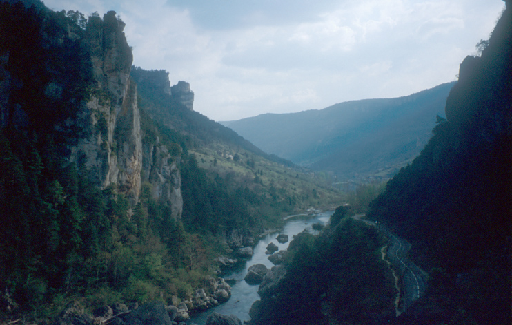
Gorges du Tarn
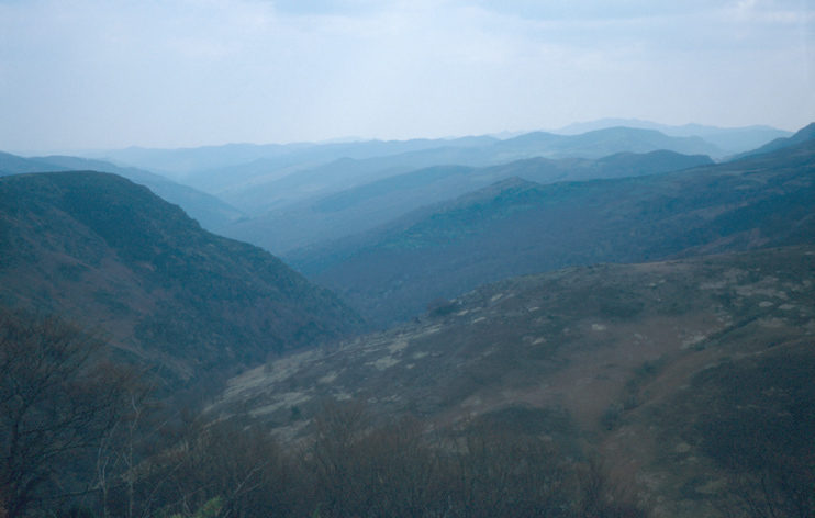
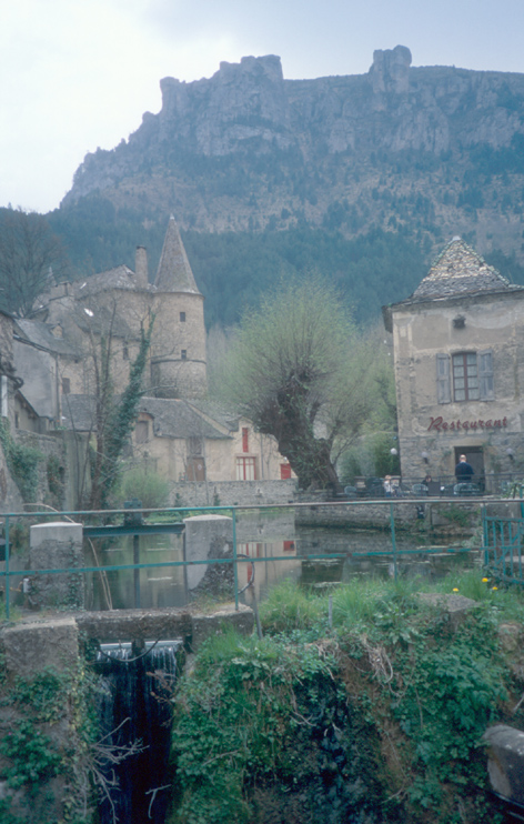
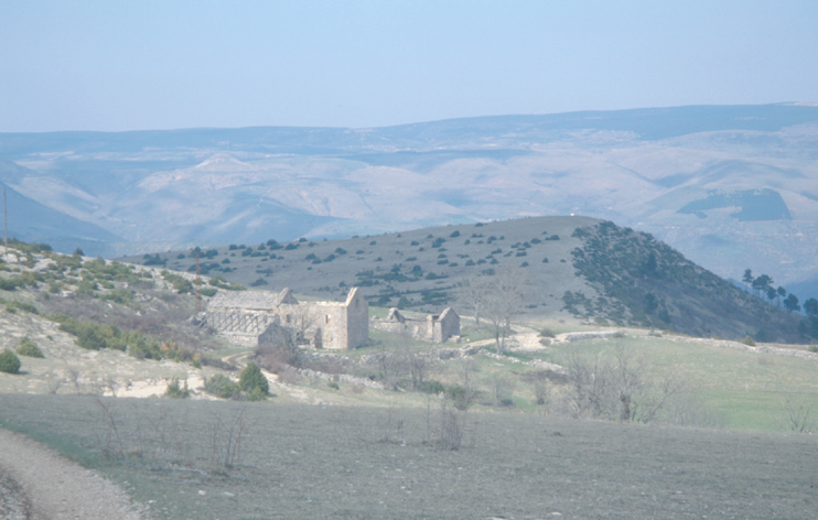
Causse Méjean and Florac
Mont Aigoual
We drove the Corniche-des-Cevennes road from St Jean du Gard to Florac. The road leads over and around some summits, which for the Corniche des Cevennes. Although some friends told us that they did it in one hour, we took a little bit more time to enjoy the sights and the landscape ;-)
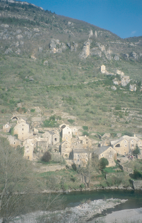
After the road over the summits, we plunged into the Gorges du Tarn. We took the road from Florac via Ste Enimie and la Malène to le Rozier. Along the road, we saw a number of nice old villages. Some one them, like Les Dètrois, can be reached by foot only.

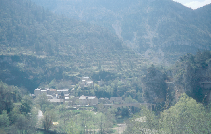
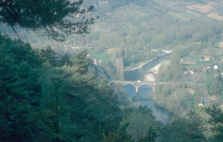
Between les Vignes and le Rozier, there is a nice viewpoint on top of a rock in the gorges. It's worth to pay the few cents for the stairs ;-)
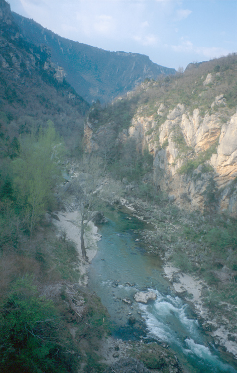
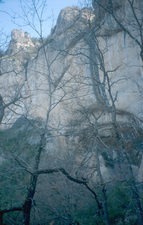
The next day, we made a 10-hour hike in the Gorges du Tarn from le Rozier to Pas de l'Arc and back. The way to Pas de l'Arc went below the cliffs, while the way back was above or along the edge of the cliffs.
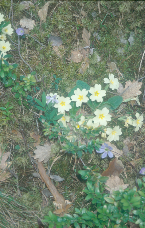
When ascending along the Jonte-river side of the corniche, we go a better and better view of the nice medieval village on the other side of the Jonte. After a while, we follow the sign to "l'ermitage St Pons" and turn back north into the Gorges du Tarn. Looking forth, the remarkable St-Pons rock becomes visible after a while. Looking back, the view is dominated by the bridge of le Rozier. All along the trial, we found typical spring flowers.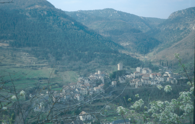
Way after St Pons, I notice a face in the cliffs: two eyes and a nose. The lower part of the face is buried in the ground.
As the trail moves closer to the cliffs, we have less vegetation on the trial, which allows us to proceed more quickly.
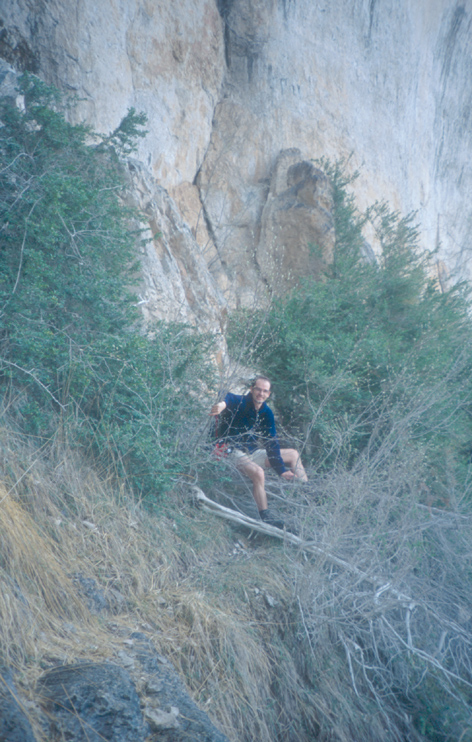
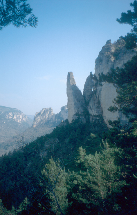
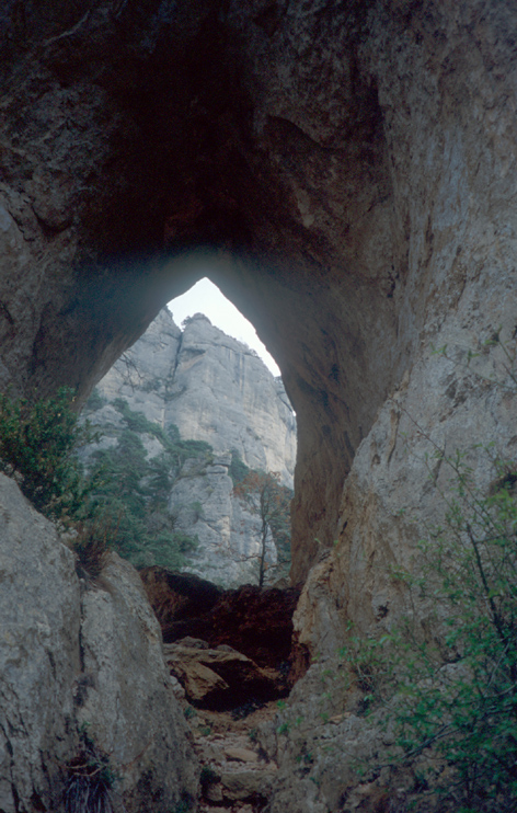
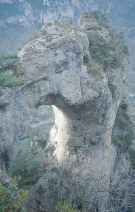
Close to the turning point, le Rozier is hardly visible any more. Finally, we reach Pas de l'Arc. It has the shape of a gothic arc, which makes it very different to the arches in Arches National Park in Utah/USA. Behind Pas de l'Arc, the trail becomes steep and finally reaches the edge of the cliffs - the turning point. On the way back, the view in the gorges is less spectacular than from below. However, there are a number of nice sights along the trail. The first sight is Baus del Biel, which is another "gothic" arc. Compared to Pas de l'Arc, Baus del Biel is simply huge.
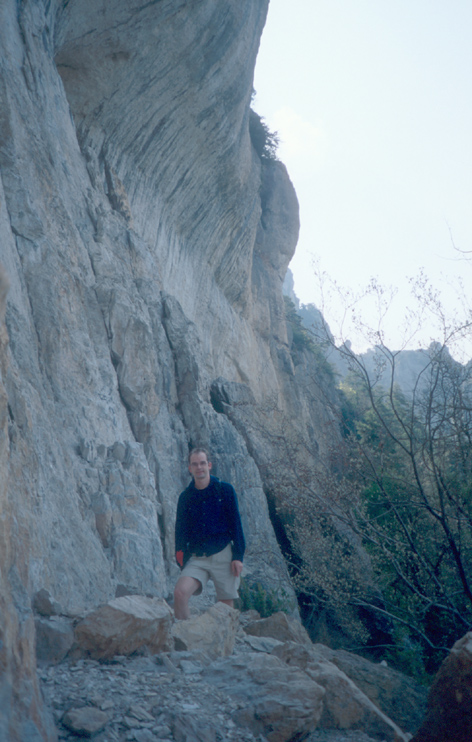
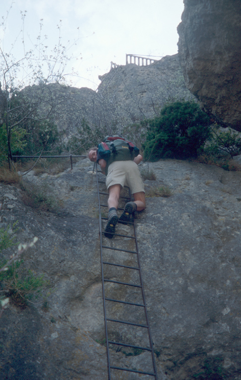
The next attraction is le Cinglegros. This rock can be reached by climbing over ladders and stairs. Unfortunately, we did not have the time to go to its summit.
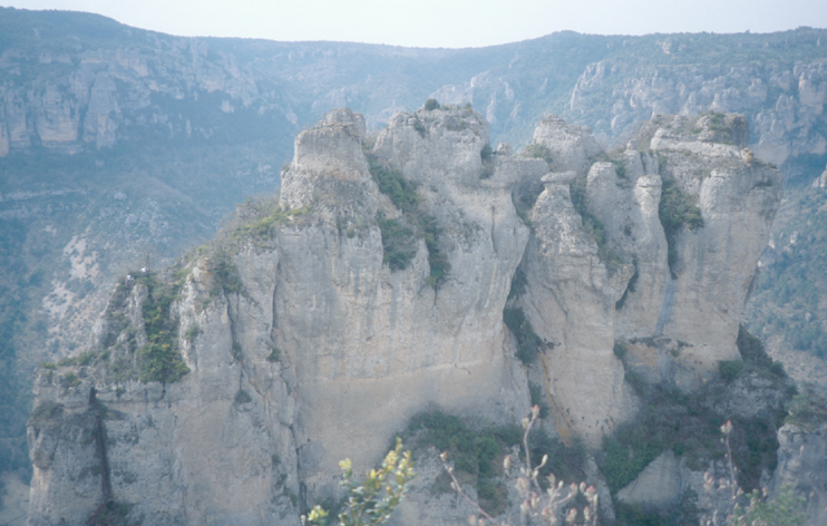
Close to le Rozier, we climbed on the Rocher de Capluc - again stairs and ladders. This is a good viewpoint over two valleys: Vallee de la Jonte and Vallee du Tarn north and west of Le Rozier.

With our hike, we followed the directions from http://randonnee.cevenole.free.fr/Mejean.html. For making the hike in the "suggested" time, you have to be in really good shape. There is also a lot of vegetation on the trail (mainly 'buis'), which slows you down. It took us some time to find the trailhead: When you enter le Rozier from the bridge over the Tarn, the trailhead is at the first intersection in(!) the village, which is at ~200m after the bridge. The trailhead is on the left side of the road with a few stairs in the beginning and then a gravel path.
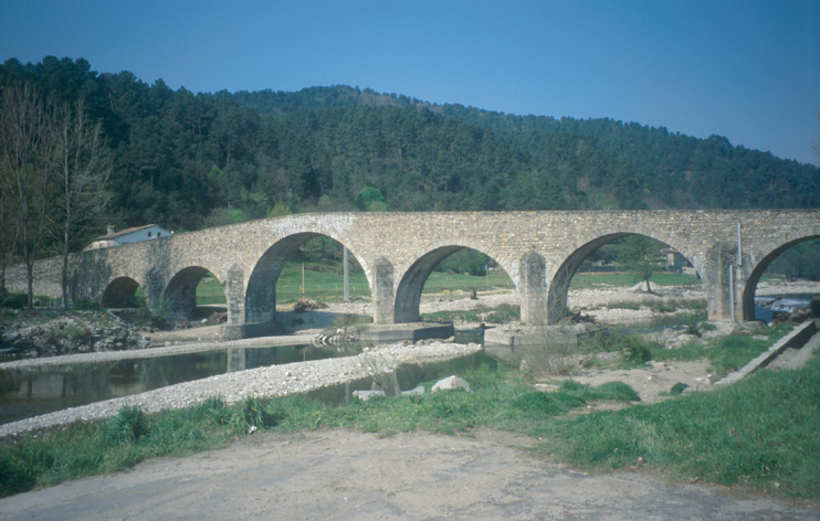
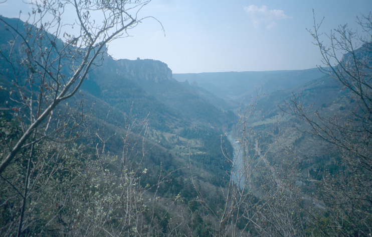
The next morning, first, we went from le Rozier to the Point Sublime Viewpoint above les Vignes. I am not sure if the view is really better than the one from the Rocher de Capluc, but at least it was a different one ;-) From the viewpoint, we drove to Florac over the Causse Méjean (causse = plateau).
By the way: The narrow, steep, and winding roads going up from the gorges to the Causse Méjean are not suitable for people with weak nerves or weak hearts ;-)
In Florac, we combined the hikes Sentier de Gralhon, Sentier des Couronnes, and Sentier de Grimoald (names according to free hiking map from park information center or tourist office in Florac).
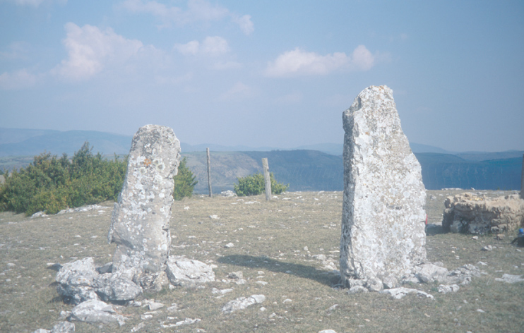
Along the Sentier de Gralhon, we ascended from Florac to the Corniches du Causse. Right at the Corniche, the Dolmen de Pierre Plate was the perfect snack place. From the dolmen, we continued along the Sentier des Couronnes, which follows the GR Tour du Méjean over the causse for a while.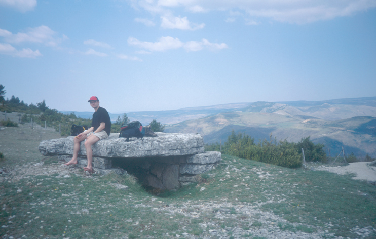
Finally, we descended through the Corniches du Causse via Croupillac, then Sentier de Grimoald to Florac. We used the Sentier de Grimoald as a shortcut to avoid le Viala de Grimoald.
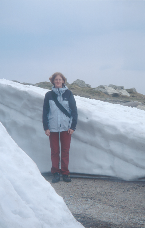
The next day, from 13:30 to 15:30, we had a really good dinner at the Auberge Cevenole in La-Salle-Brunet, which is 2km southeast of Florac on the N106. Then, we drove from Florac via Mont Aigoual, Vallee de Herault, Pont de Herault, Ganges, and Anduze to Ales.
On Mont Aigoual there still were big, thick patches of snow. This lead to different reactions like "Good that I still have my winter tires on the car!" and "I did not come here to see snow!" ;-)