...if you came to this page from another page than my April 2002 tour overview page:
- Further information can be found on the tour overview page at http://www.markus-nick.de/usa-02.html.
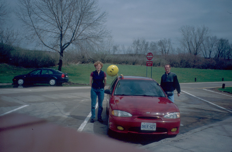
We start in Toronto with Marie-Paule's car. Going from Toronto to Arizona saved the cost of the rental car, but it took us three days without seeing very much.
The idea is to follow the way of the Route 66 via Chicago, St. Louis, Oklahoma City, Albuquerque to Flagstaff/AZ. From Flagstaff it is approx. 1.5h to Grand Canyon Village.
On April 13 is the first stage from Toronto to St. Louis. In the morning of April 14, we take some time to visit the Gateway Arch in St. Louis, which is located next to the Mississippi river.
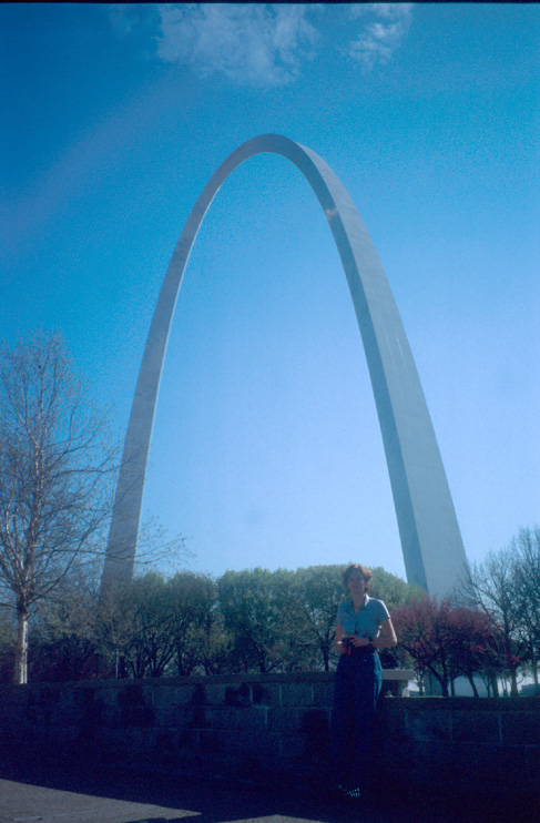
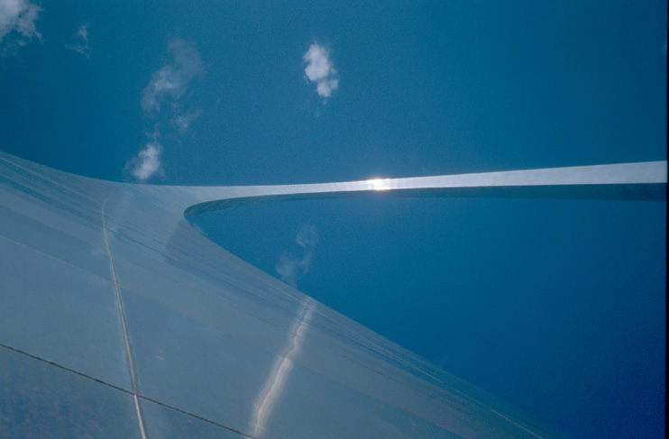
The Gateway Arch impresses by form and size. It is higher than any other building or monument in St. Louis. Its size and form make it almost look like an extra-terrestrial phenomenon. This is also supported by the remarkable triangular cross-sectional shape of the arch.
After St. Louis, we follow the I44 westwards. For the night, we stay in Clinton/Oklahoma.
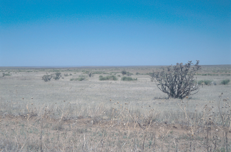
On April 15, we drive from Oklahoma to New Mexico. The landscape changes from green fields to sandy desert. From a picnic area at the highway, we see our first cactus in the desert.
We stay the night in the remote Bluewater Campground, which is located close to the continental divide and not far from Arizona. Here we make our first experience with stronger wind: Because of the wind, the gas burner is not strong enough to make the water boil. We cook in the washroom where is no wind.
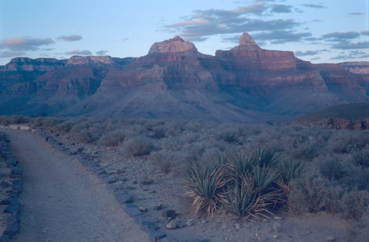
On Apr 16, starting from Bluewater Campground, we want to reach Grand Canyon Village in the evening. On the way, we plan to visit Window Rock and Petrified Forest NP.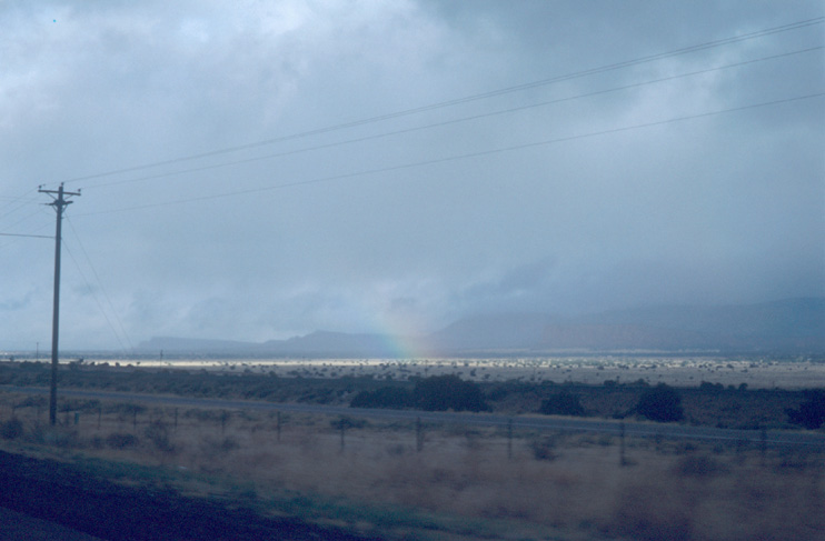
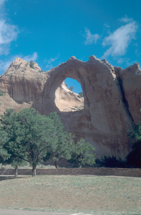
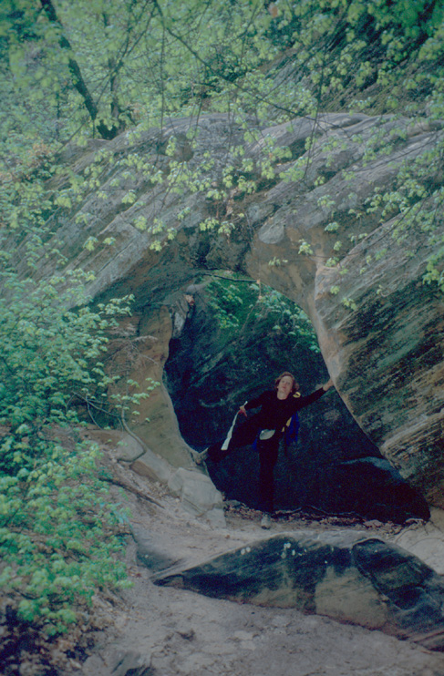
From highway close to Bluewater, we watch some rain showers and a rainbow in the desert. We think of rain in Grand Canyon and don't like the idea. But the showers end soon and we forget the unwelcome idea. Window Rock is the first arch or hole in a rock that we see in this holiday. Sure, there are a number of larger arches in Arches NP. However, this nice arch is located in a Navajo reservation and it is located above a small park with some small monument giving you some lessons in history.
After Window Rock, we head for Petrified Forest NP.
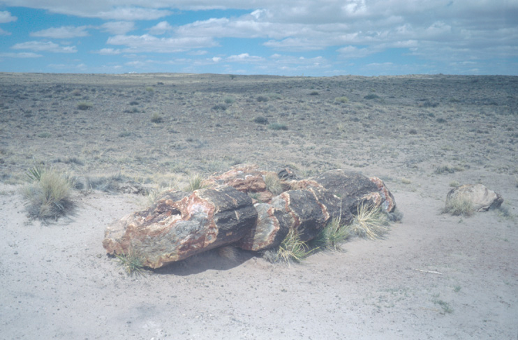
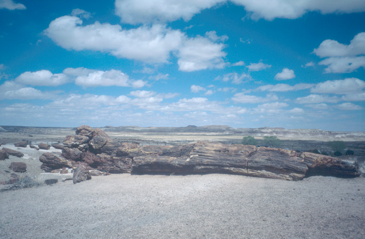
Petrified Forest NP is famous for two items: painted desert and petrified wood. The painted desert is one of the four types of deserts in the canyonlands area.
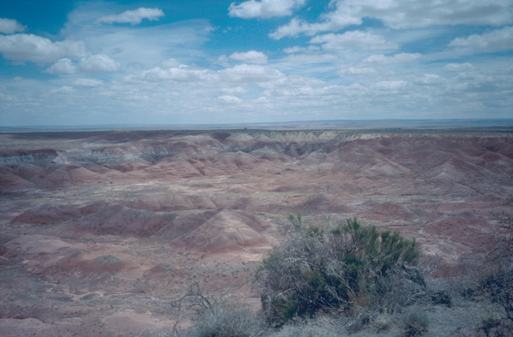
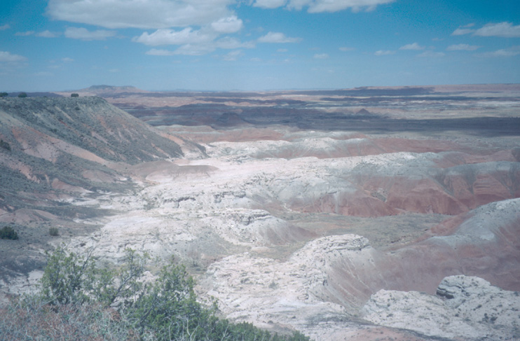
At the visitor center at the park entrance, they have a nice video that explains how the wood became petrified. In the park, you find the largest existing/known collection of petrified wood.
From Petrified Forest NP, we continue on our way to Grand Canyon. At Flagstaff, we leave the Interstate and head for Grand Canyon Village. The road becomes smaller and goes up and up and up to the plateau with the canyon. When we reach the campground, it is already dark. Some piece of paper at the gate tells us where our site is.
At the park gate, we ask about snakes. The answer: "You will hardly see any snake. It must be 20 years ago that someone got bitten by a snake here."
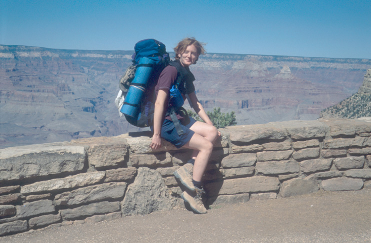
We also take the food for the hike out of the car and put it on the table. "Wow! Do we really need that much!?" "Four cereal bars per day should be enough..." So, we put some stuff back into the car. Finally, the backpacks are packed and we can go to sleep.
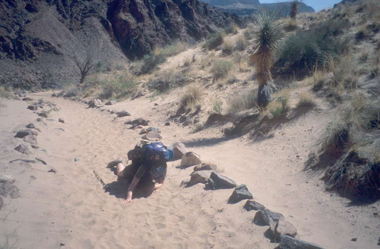
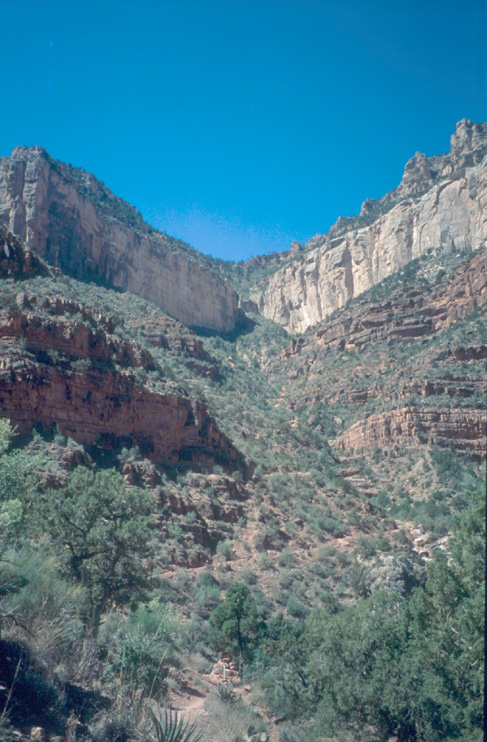
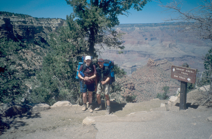
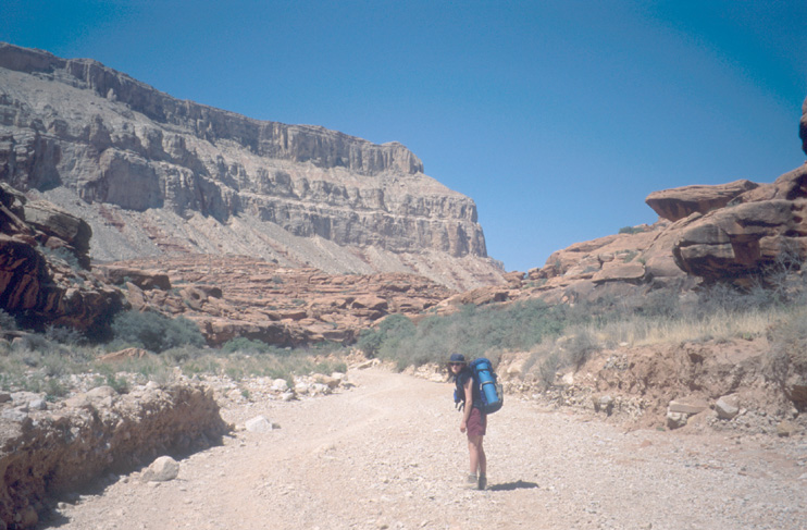
Our idea was to start early... Go to the shower, have breakfast, pack the tent and leave. First surprise: The shower was still closed. After "loosing precious time", we finally manage to be at the South Kaibab Trail Head at 10.45am where we start our descend to Bright Angel Campground.
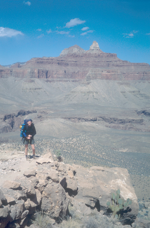
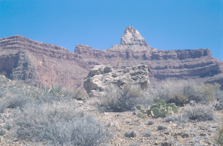
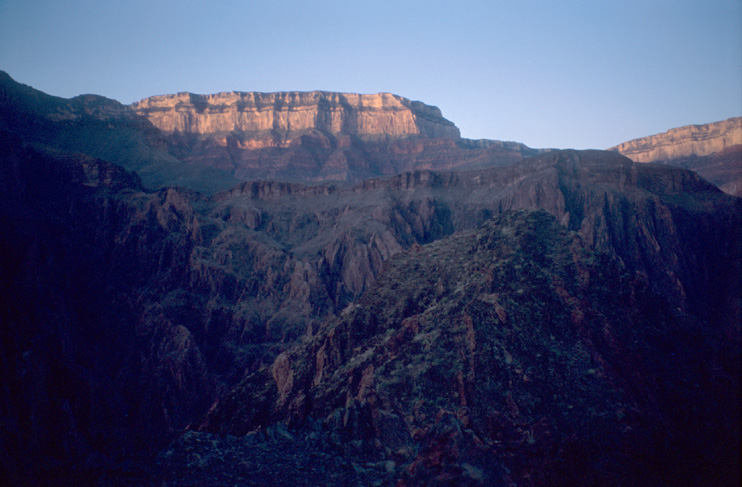
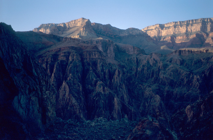
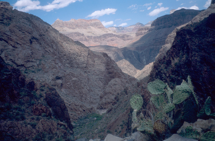
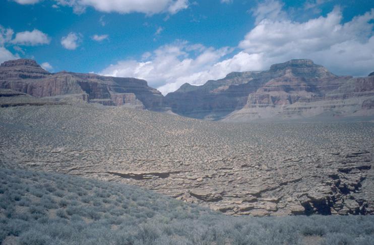
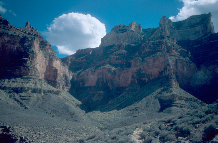
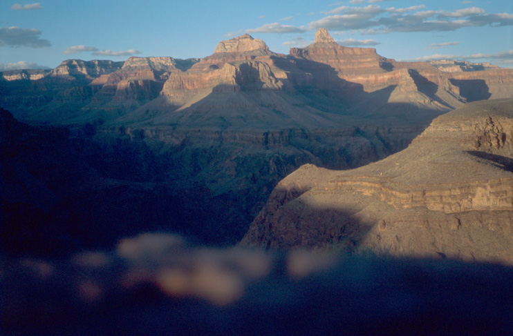
In the upper part of the trail above Tonto platform, we enjoy the view over the canyon to the north side and the wide Tonto platform on north and south side. Further down, the Zoroaster Temple becomes more and more a landmark. Hardly noticed from the rim, it now attracts the eyes with its sharp, pyramid-like peak.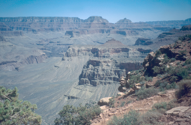
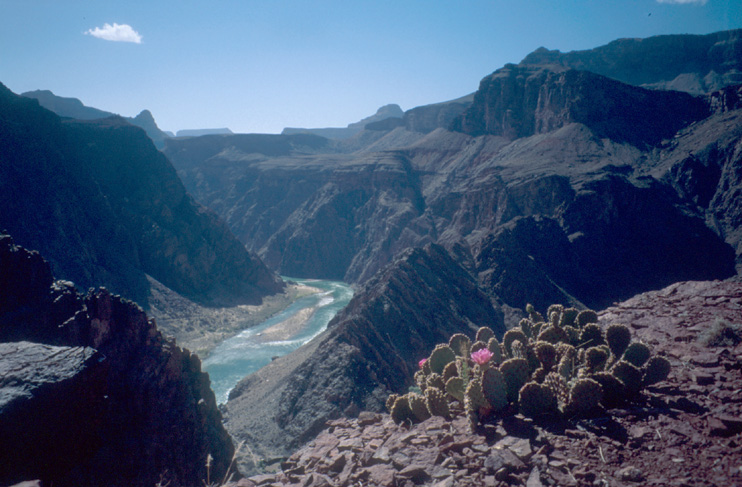
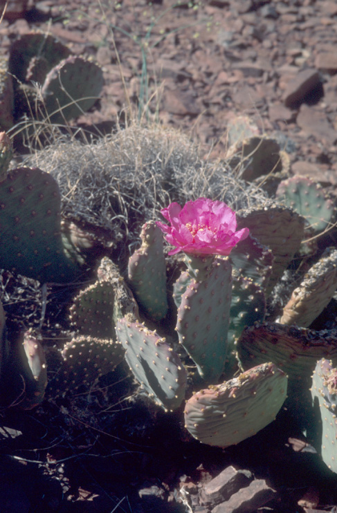
Very surprising is the wind, which is becoming stronger and stronger. So, it happens that Marie's cap is blown from her head by the wind and it cannot be found again. On the Tonto platform, the wind is almost like a sand storm. After the Tonto platform, the trail switchbacks down to the Colorado river. Way below Tonto platform, at a nice viewpoint for the river, we see our first cactuses with blossoms.
To finally reach the Bright Angel campground, we have to cross the Colorado on a suspension bridge - the Black Bridge. At 4:30pm, we reach the campground.
The plan for today is to go on Clear Creek Trail as far as possible for half of the day, have lunch and return afterwards to Bright Angel Campground.
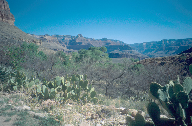
We remember this day as the day of cactus blossoms. On no other trail we have seen so many cactus blossoms as on Clear Creek Trail: Beavertail Cactus, Barrel Cactus, Hedgehog Cactus and some cactus we could not identify.
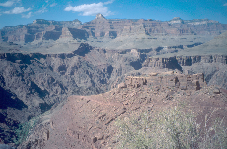
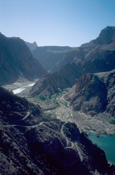
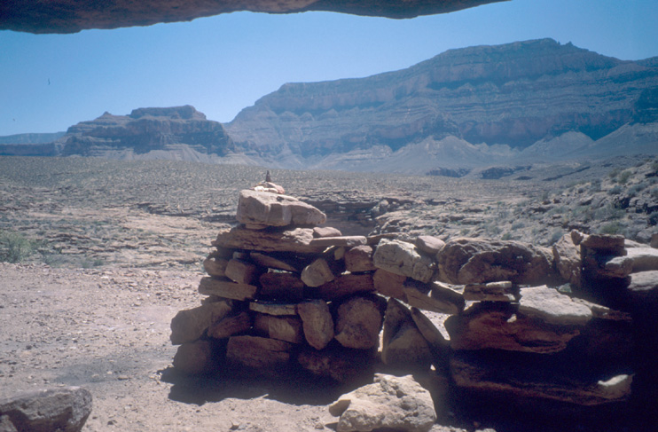
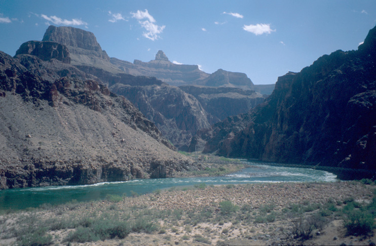
Besides the cactus there were also a number of flowering Agave Lechuguillas, which are easy to recognize with their ~2-3m high straight, single thin trunk holding the blossoms. For the trail: It takes approx. 50min to reach the viewpoint. Starting here, we get a number of good vistas on the Colorado and on the switchbacks of South Kaibab Trail below Tonto Platform. Finally, the trail leads away from the Colorado and we ascend to the Tonto Platform. Reaching the Tonto Platform, we have an astonishing wide, far view.
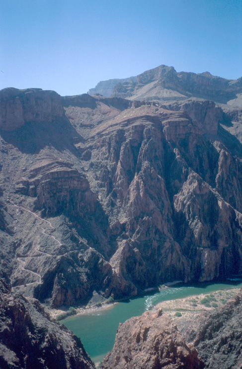
It is funny to notice that -although it looks around like mountains- we are actually in a canyon ~1000m below the normal surface.
On the trailside close to Zoroaster Canyon, we find a natural nice shady little shelter. Immediately we decide that this is the perfect place for our lunch break.
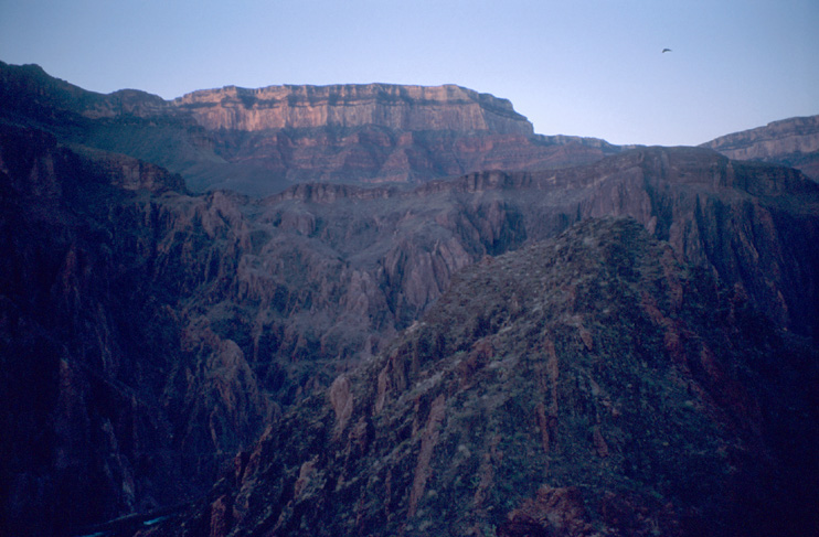
We decide to watch the sunrise from one of the viewpoints on the next morning. My little pocket computer (a Handspring Visor) tells us the time of the sunrise: 5:55am.
We wake up at 4:50am to go the viewpoint on Clear Creek Trail to watch the sunrise. Being really effective, we manage to be at the viewpoint at 5:50am. The timing was perfect and we could watch the sun slowly enlighting the canyon starting with red and changing into brighter, lighter colors.


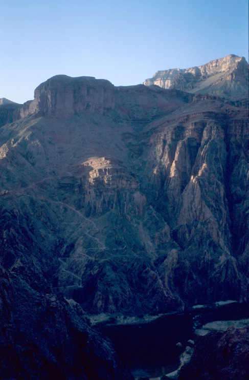
On the last picture, you can also see the switchbacks of South Kaibab Trail between Tonto platform and Colorado river.
April 19, we have to reach Indian Garden Campground. So, after watching the sunset this morning, we manage to leave the campground at 9:30am.
We cross the river over the Silver Bridge and stroll along the riverside on the River Trail. Along the riverside, there are some yuccas on the beach. The sand on the trail is very fine and makes walking difficult.
Close to the riverside, we take some funny pictures for planning a desert movie ;-) After a while, the trail turns away from the Colorado. On a beach with rocks and fine-grained sand, we enjoy our last view inside the inner canyon.

The trail goes upwards trough the canyon with Garden Creek. Everything here: Rough landscape and some oasis with green trees.
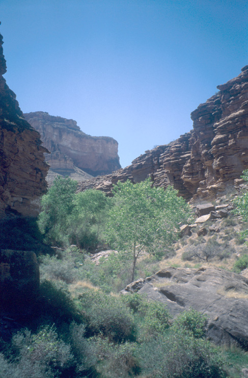
Finally, we reach the end of this side canyon and come on the wide Tonto Platform. Some minutes later, at 3:30pm, we are at Indian Garden Campground - a oasis with trees and water on the desert-like Tonto Platform.
When we started to cook, we noticed that our gas was almost empty. Unexpected because usually these gas cartridges last very long. But the strong wind required more gas and now we are short of gas. Marie manages to cook our dinner on the burner of our neighbours. When the ranger comes, we tell him our problem. Unfortunately, he does not have a gas cartridge of our type. But, fortunately, he helps us with a really strong burner.
When checking our remaining food, we also notice a lack of food! We should have packed everything that was on the table in the campground on the rim before we started the backcountry hike! Well... Every person gets his share of the remaining food and has to manage it on her/his own...
At around 5am we wake up: rain! And our backpacks are hanging in the rain! Marie bravely volunteers to put her rain poncho over the backpacks. Good. Now, our stuff is safe and we continue to sleep. Fortunately, the rain stops later.
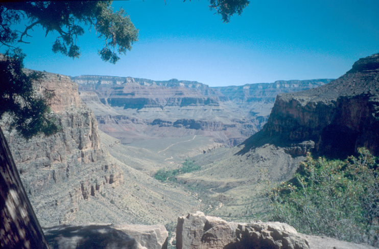
The plan for this day: Plateau Point in the morning, then Tonto Trail west and sunset at Plateau Point in the evening. Sunset is at 7pm according to my pocket computer. After breakfast, we head for Plateau Point at 9.40am.
Plateau Point provides a very good vista into the inner canyon. Additionally, it is also possible to hike from the rim to Plateau Point and back in one day. We reach Plateau Point within one hour and stay there for another hour to enjoy the view.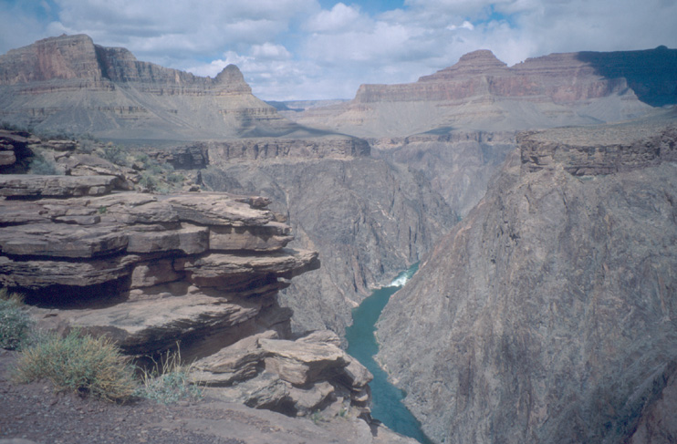
From Plateau Point we go back to the Tonto Trail Junction and go westwards on the Tonto Trail.
Tonto Trail meanders along the platform and we walk from one amphitheater to the next. Compared to Clear Creek Trail, the cliffs are higher and closer. However, the vegetation is different: mainly some small bushes with sharp needles.
We stop at Horn Creek for a while. But the beauty and silence is deceptive: Above Horn Creek once was a uranium mine and the water of the creek is still radioactively contaminated.
At 2:40pm, we are at a viewpoint to the Colorado, which is located 1.5 miles before Salt Creek according to book and map.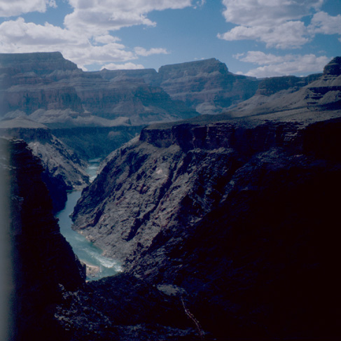
Unfortunately, we had left the backpack somewhere on the trail (where we had lunch) and i had only one picture left in the camera what i noticed when being at the viewpoint. Damn! A part of the picture was cut off in the development process - as usual for the last picture on a film :-(
We turn around at the viewpoint and were back at Plateau Point for the sunset at 5:25pm.
We met only 3 persons on that trail for the whole day. A really lonely trail compared to Bright Angel Trail and South Kaibab Trail. And for the whole day, we were kidding about our lack of food...
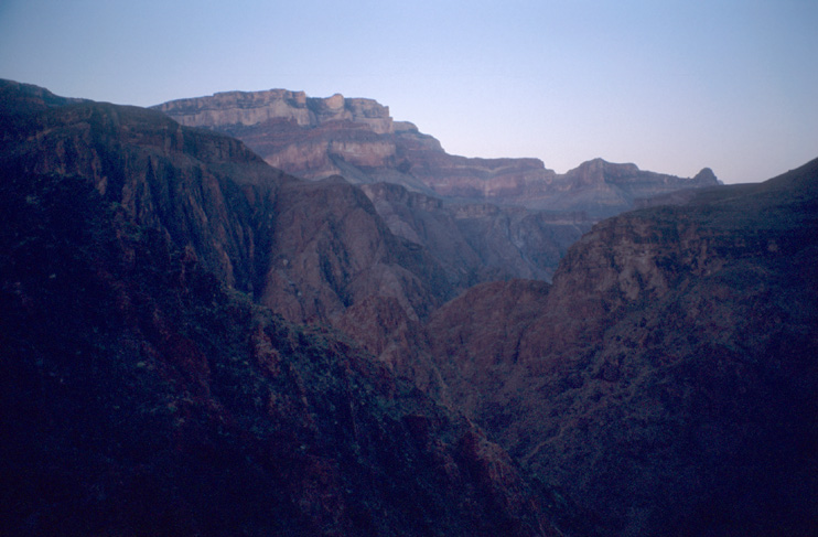
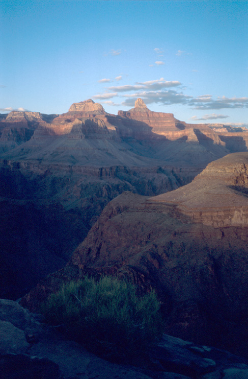
At Plateau Point, we enjoyed the sunset with the changing colors in the direction of Zoroaster Temple. The rock became more and more red. Almost no change in the colors happened between 5:30pm and 6:30pm. But then, in the last 20 minutes before sunset, the colors rapidly become much more intensive.
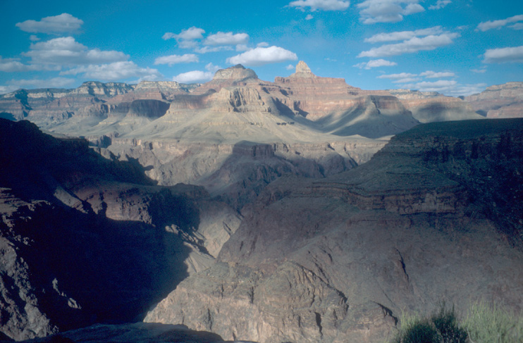

After the sun was below the horizon, we returned to Indian Garden Campground. Zoroaster Temple was still colored red by the last remaining light.
This is the last day for Grand Canyon. We hike out - as planned. First, we pass by the house of the rangers. Wow cool view!
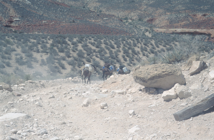
Along the trail upwards, we meet a number of mule trains. We are beginning to be sick of the smell of the mule...

The trail switchbacks to the rim and seems to be longer and longer... We take some breaks and enjoy the enjoy the vistas and the change of the view.
Finally, we reach the rim.
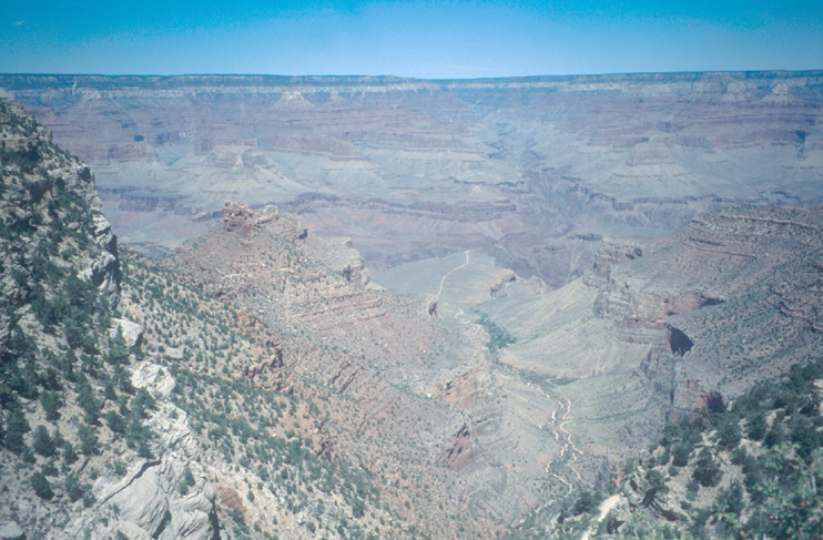
We decide to walk along the rim - just for the view. However, with our big backpacks we feel like aliens among all those people. Funny that we regarded people with inappropriate shoes and clothing on the trail as aliens. On the rim, it is the other way around.
The canyon looks also very different from the rim. Zoroaster Temple is a really remarkable peak when you are in the canyon. On the rim, it is just one amoung many and you hardly notice it.

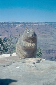
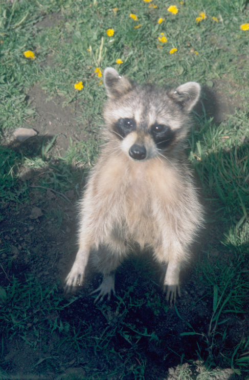
A squirrel on the rim
We call the Havasupai reservation campground and made a reservation for the 2nd next night. For this night, we stay in Williams.
Starting at Williams, we follow the old Route 66 to the Supai Junction. From the junction, it's 70 miles to Hualapai Hilltop - the trailhead.
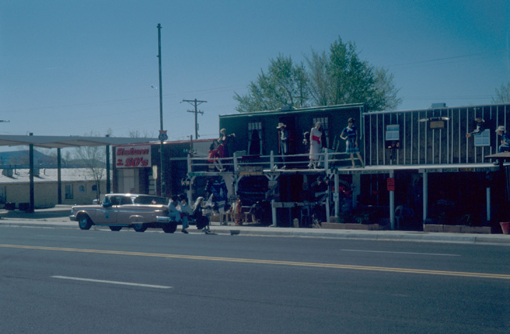
On the old Route 66 we pass through the old town of Seligman, a "typical" Route-66 tourist-attraction town.
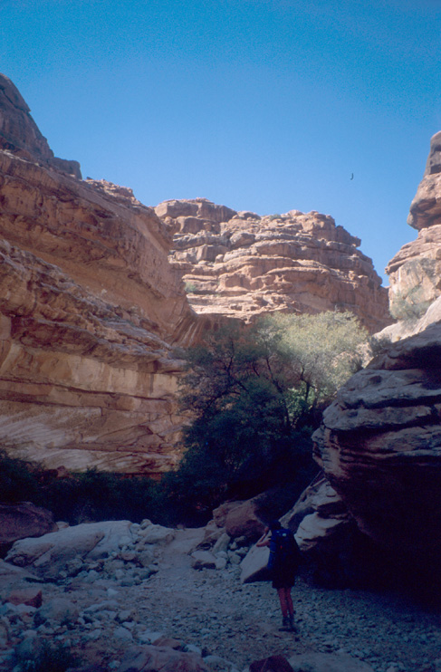
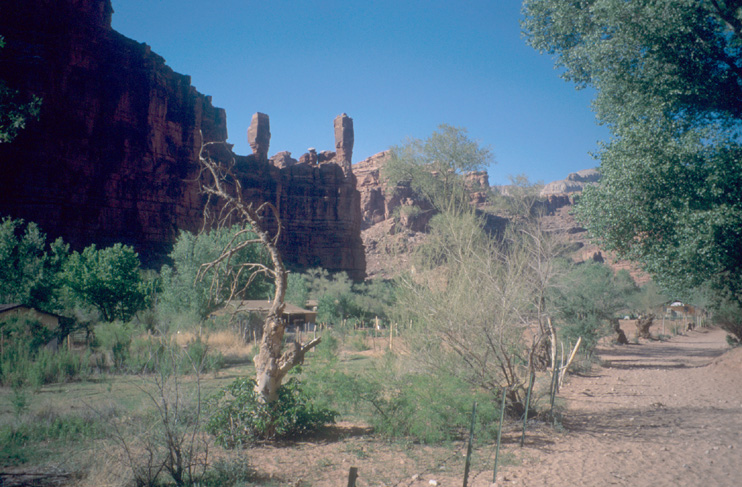
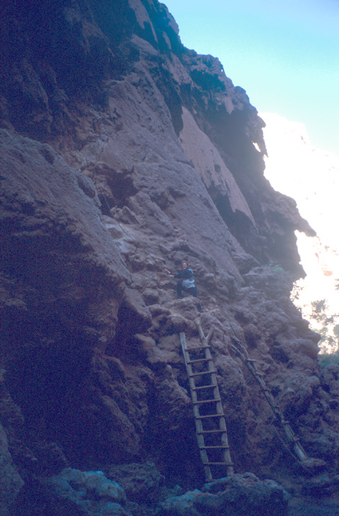
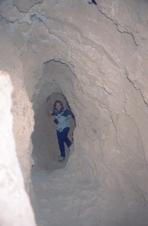
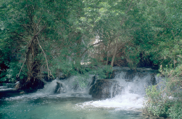
The trail leads from the parking lot at Hualapai Hilltop through the dusty, dry Hualapai Canyon to Supai Village (8 miles). From the village, it is 2 miles to the campground.
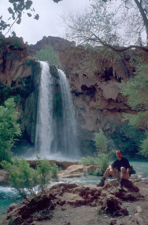
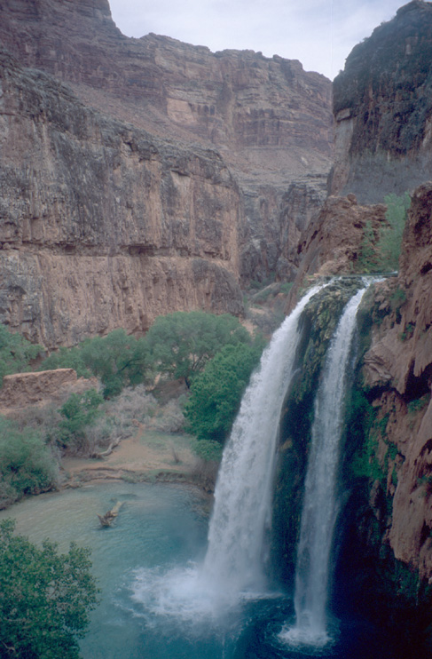
The next morning, we visit the famous waterfalls.
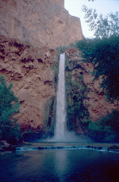

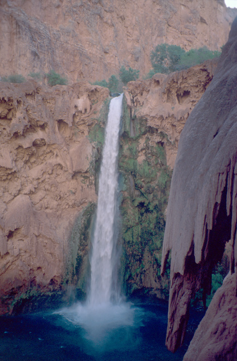
After packing our stuff at the campground, we start our long hike back to Hualapai Hilltop. However, first we have a look at the wonderful waterfalls along the way to Supai Village.
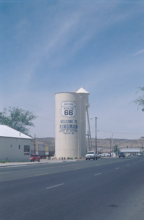
back at the hilltop, we drove to Kingman.
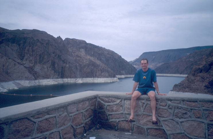
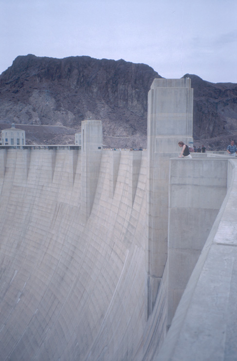
We have a brunch at the famous Mr. D's Diner in Kingman. From Kingman, we follow the highway to Las Vegas. At the Hoover Dam, which is on the border of Arizona and Nevada and which produces also the energy for Las Vegas, we stop for a while and look at the huge huge dam.
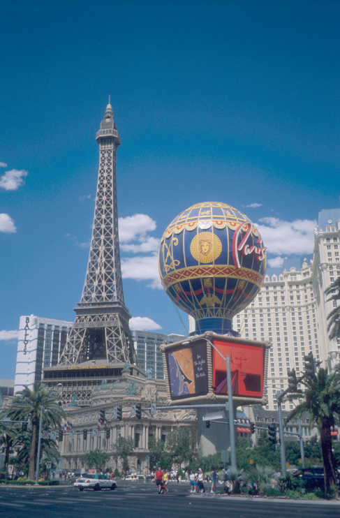
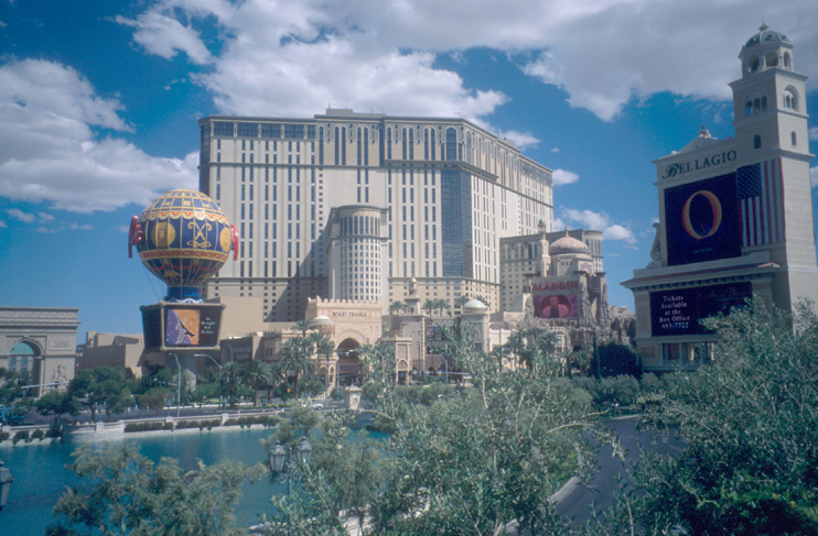
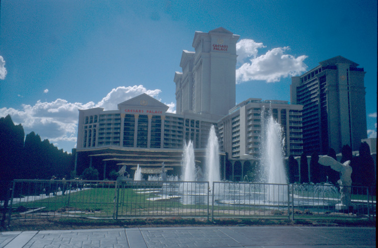
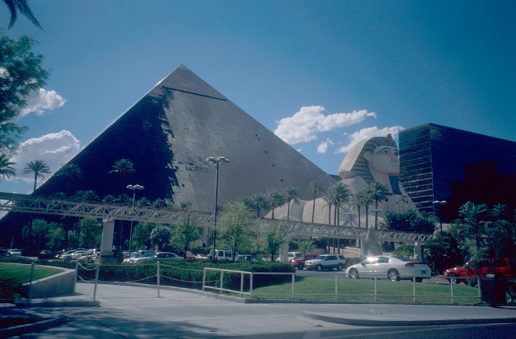
In the evening, we do some laundry at the hotel. Afterwards, we visit the strip and gamble in one of the casinos.
We use the morning to drive along the Strip and see all the casinos, hotels, chapels...
From the Strip, we go on the highway towards Zion NP.
First, we go to the visitor center to get some information on the trails and ask for recommendations.
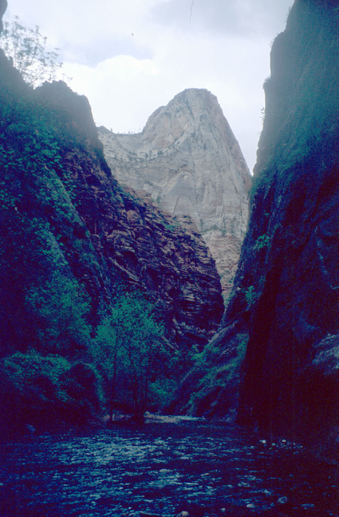
Due to some thunderstorms expected for the afternoon, there could be some flash flooding in the Zion Narrows and they do not recommend to go into the Narrows. However, there is the Hidden Canyon, which is always dry. Another nice hike were Angel's Landing.
We decide to make the riverside walk to get a glimpse into the narrows and do Hidden Canyon afterwards. Angel's Landing is put on the schedule for the next day. For the Hidden Canyon Trail, we start at Weeping Rock and hike uphill. Half way to the saddle is the junction for Hidden Canyon.
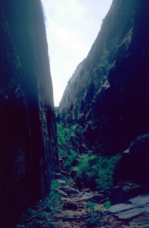
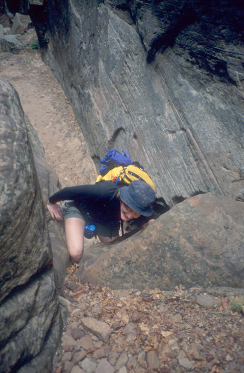
The trail is not difficult. However, after the end of the official trail, scrambling is necessary at some points. At some points, you can reach the walls at both sides of the canyon with your arms.
When we are deep inside Hidden Canyon, a thunderstorm and some rain starts. We use on overhanging rock as a shelter and wait until the thunderstorm stops.
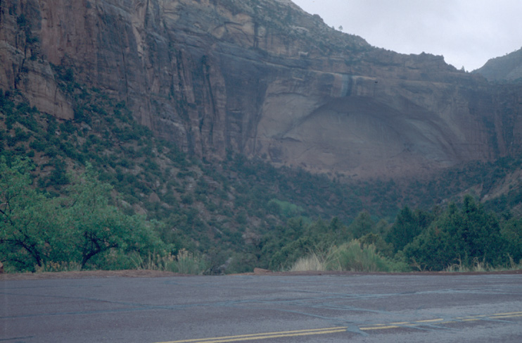
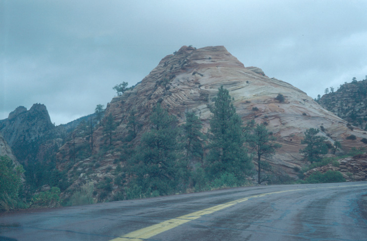
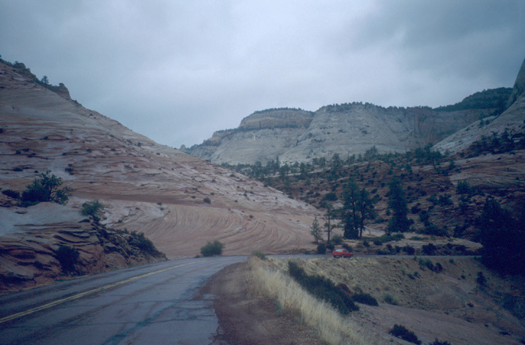
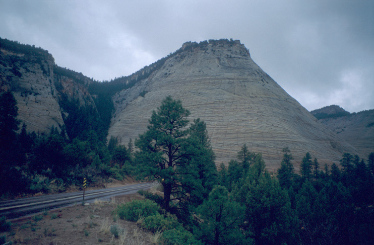
In the night, it starts to rain. All around the sky is grey. So, we decide to drive to Arches NP. We use a rain pause to pack our stuff and leave eastwards. Along the highway in Zion NP, we see a number of interesting, different rock formations.
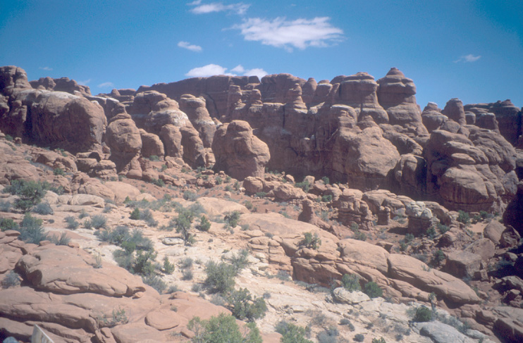
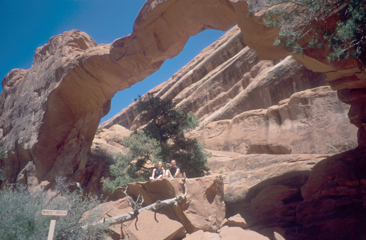
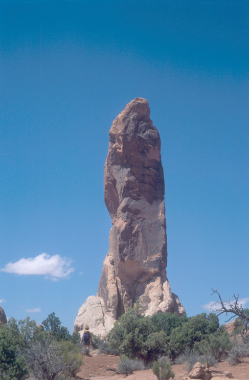
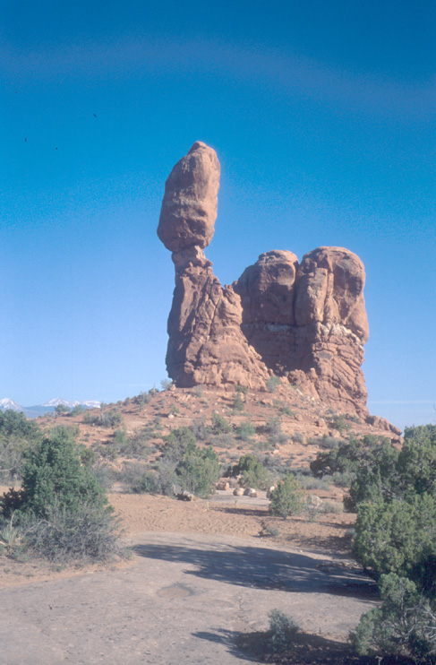
We plan to stay two days in Arches NP. The park which is famous for its arches - more than 2000 (only those bigger than 1m count).
For the first day, we want to visit Devils Garden and Delicate Arch. Furthermore, we want to see the sights along the road.
One of these sights is the Fiery Furnace, a place where new arches are "born". It will take a long time until some of these rocks become fins and then arches.
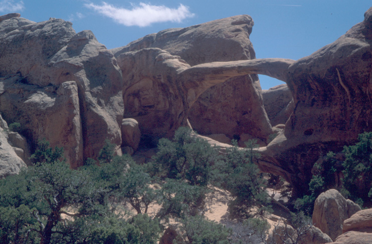
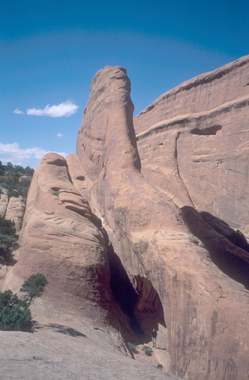
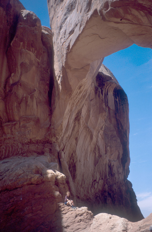
Devils Garden Trail brings us the some of the most famous arches. We also do the "primitive trail", which is a nice alternative to going back the same trail.
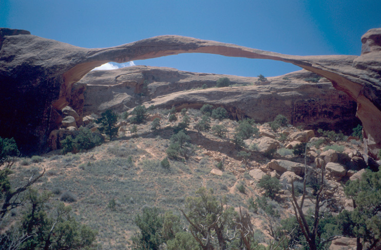
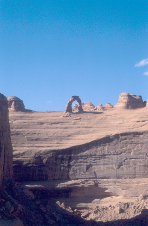
Just before the primitive trail rejoins the normal trail, we have a nice view on some fins and the snow-capped Mt. Peale. Unfortunately, it is already quite late and we do not have the time to the hike that would take us very close to the famous Delicate Arch. We can only go to a viewpoint. On the way back to the campground, we stop a couple of times to have a closer look at some rocks.

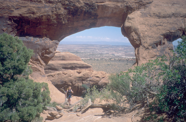
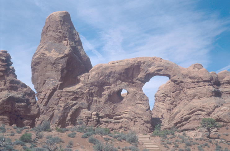
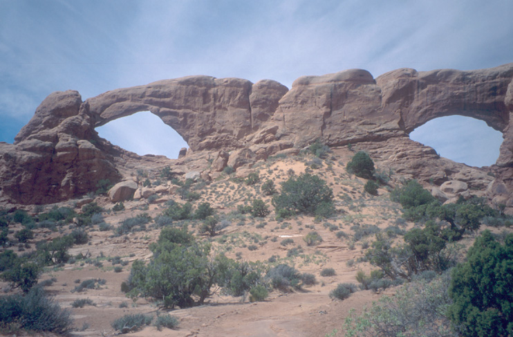
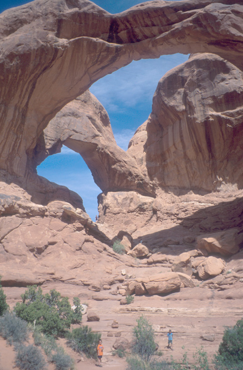
In the morning of the 29th, we visit the Windows Section of the park. Turret Arch is famous and the Double Arch impresses by its size.
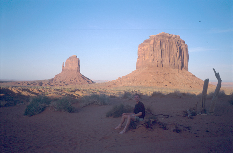
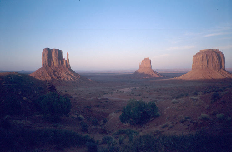
Around noon, we leave Arches NP and head for Monument Valley.
We arrive in Monument Valley in the late afternoon. We have a short look at the visitor center: For a visit of the restricted area we would have to book a jeep tour. However, the picture of the arches etc. we would see there do not impress us. We have a look on the dirt road from the visitor center. It seems to be ok. So, we decide to drive the loop with Marie's car.
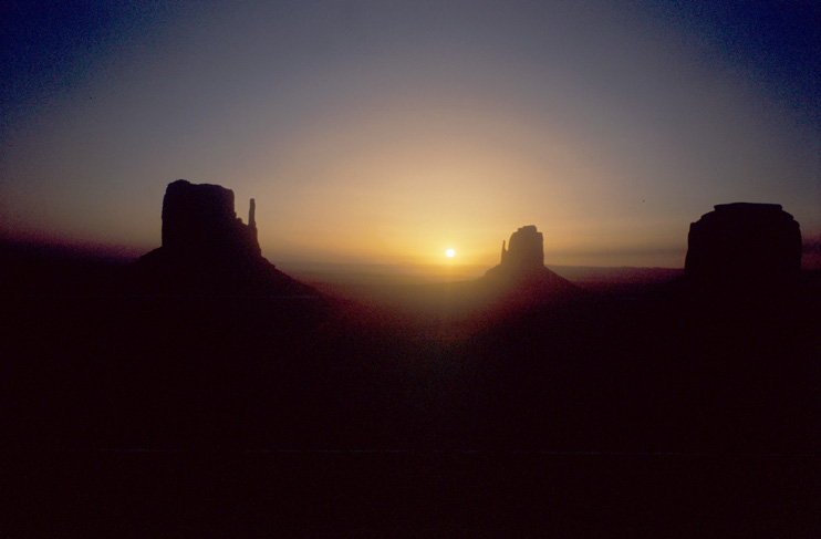
The campground is the most windy place where we stayed. Again, we have to cook in the washroom.
Early in the morning, i wake up by "Markus! Wake up! Look outside! The sunrise!" - "WOW!"
We packed the tent and drive to Mesa Verde NP.
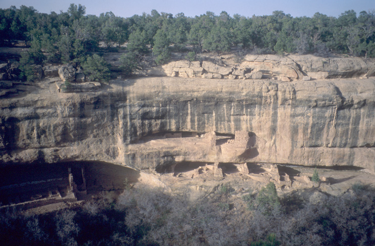
Mesa Verde is famous for its numerous cliff dwellings of the Anazasi people.
Our initial plan is to stay for the night in the Mesa Verde Campground and visit the park April 30 and April 31(!). I wonder about the bear-proof trash cans at the parking and ask a ranger at the visitor center about bears. "Oh - our bears are nice and quiet. Just put everything in the trunk and you will be fine." We buy a ticket for a guided tour through the famous Cliff Palace dwelling.
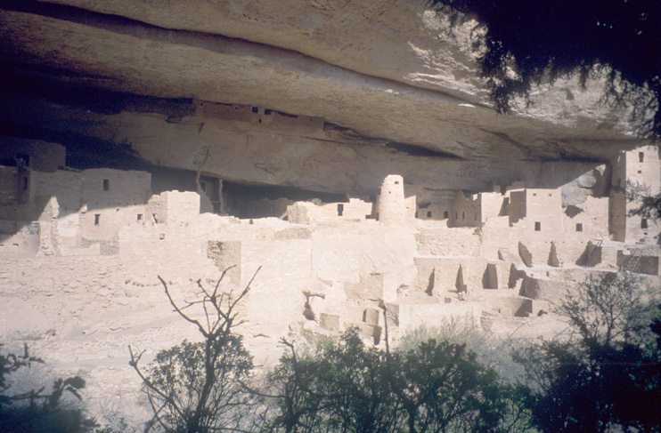
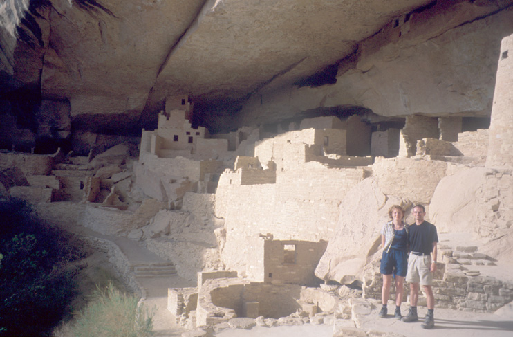
After the Cliff Palace Tour, we drive along the loop in the park and have a look at the other cliff dwellings. Cliff Palace is definitely the largest one. It's funny that you only notice the real size of a cliff dwelling when you are standing right inside.
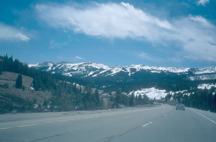
On the way to the campground, we notice that there is no April 31 and decide to drive as far as possible on the way back. Unfortunately, we take a road (HW550) that leads high through the mountains of Colorado (several passes at more than 10,000ft). The winding road might be very scenic at daylight, but it is not really nice to drive there in the dark. So, we do not get that far and stop in the town of Montrose.
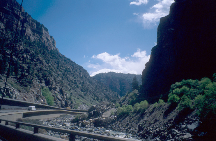
On May 1, we go from Montrose/CO to Kearney/NE. The I70 goes through the narrow Colorado Canyon between Grand Junction and Glenwood Springs. While Colorado impresses with mountains, Nebraska "impresses" with cows. Numerous cows. You begin to hate the smell... On May 2, we manage to drive from Kearney/NE to Somewhere/IN. We are happy to leave the cows and their smell behind.
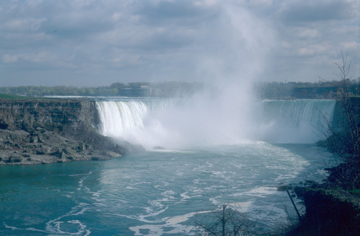
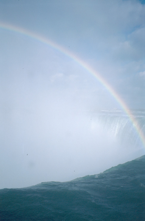
On May 3, we go from this Somewhere/IN to Stratford with a "short" detour to Niagara Falls. In Niagara, we meet one of Marie's special friends.
We go along the river and on the Skylon Tower to see the falls.

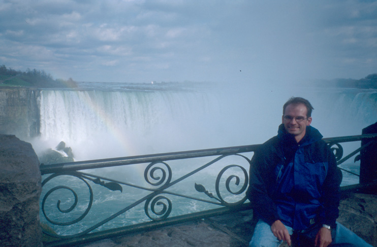
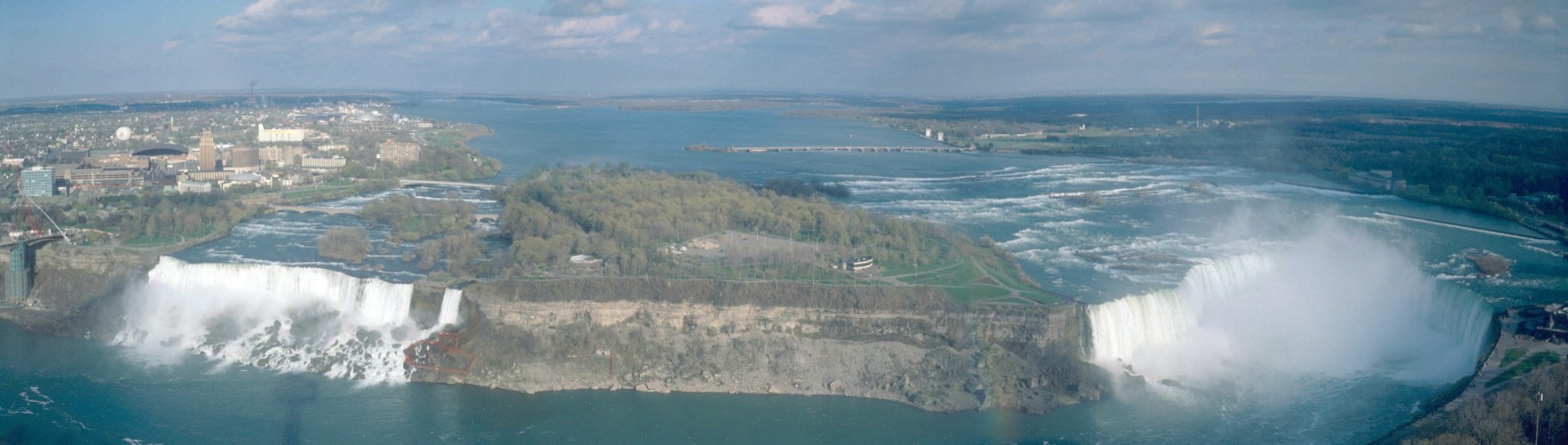
View from Skylon Tower [zoom]
May 4: Stratford to Toronto Airport. My holidays are over. I must return to work in Kaiserslautern :-(