MARKUS NICK
GREAT PLACES IN THE CANADIAN ROCKIES
Here are some recommendations based on my Oct-1999 tour. My tour started from Calgary. Before I went to the rockies, I had a look at Calgary and gave a short visit to the badlands.
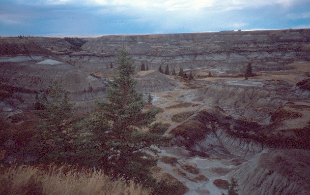
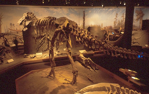
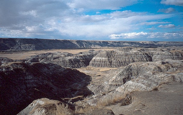
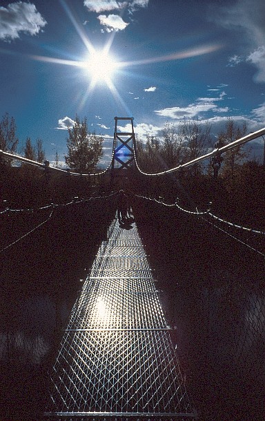
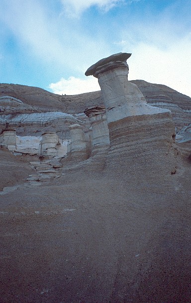
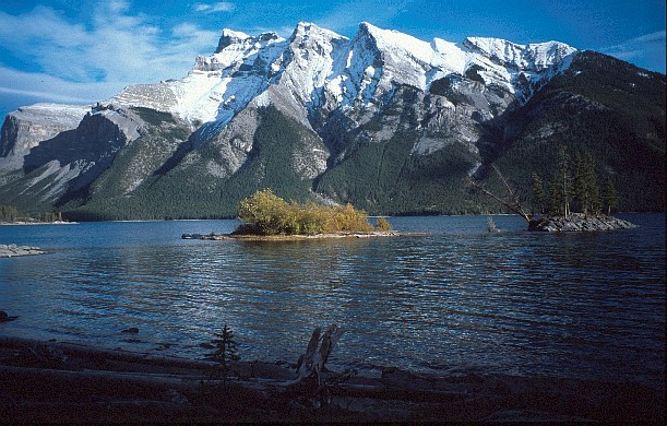
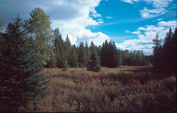
You do not need too much time for Calgary: Besides the skyline, there are the devonian gardens and a chinatown in the city center. The Glenbow Museum has a good exposition on the culture and history of the west ranging from Indian artifacts (even a complete tipi!) to stuff from the first settlers. The university and the Olympic area are the places where the movie "Cool Runnings" was filmed. A few miles south of downtown is the Calgary Heritage Park. Here you can dive into the Calgary of the 1850-1920s. In the north you see the skyline with the Calgary Tower. And in the west you can see the snow-covered peaks of the rockies looking very close, but still a hundred kilometers away. The badlands northeast of Calgary are worth a one-day trip from Calgary. One of the badland areas is Horse Shoe Canyon, which is besides the road from Calgary to Drumheller. The major part of the badlands is located in a valley of the Red Deer River. Right in the middle is the town of Drumheller. Driving through the valley brings you to beautiful and interesting sights. A few miles north-west of Drumheller on the Dinosaur Trail, you find the renowned Royal Tyrrell Museum, which is famous for its dinosaur exhibition. Next is the Horse Thief Canyon viewpoint. In the very northwest you cross the river with a ferry (for free!). Southeast of Drumheller, in the town of Rosedale you will find a nice pedestrian suspension bridge over Red Deer River. Further southeast, there are some of these funny hoodoos very close to the highway. These still have their capstones. From the west end of Calgary it's an hour to drive on Highway 1 along Bow River. Close to Banff, the Garmisch of the rockies, you find Lake Minnewanka, the largest body of water in Banff National Park. The picture was taken on a walk along the lakeshore to Stewart Canyon [1]. From the Bow Valley Parkway, ca. 20km north of Banff, you reach Johnston Canyon - a limestone canyon with seven waterfalls. The highest are the Upper Falls (30m) [1]. From the Upper Falls, you can hike to the Ink Pots, the spring of Johnston Creek. The whole tour takes an afternoon (best lightning).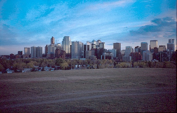
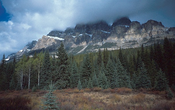
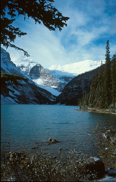
Half way between Banff and Lake Louise on the Bow Valley Parkway are the Moose Meadows. The highest peak of Castle Mountain is at 2766m. From a car park at Castle Junction you can hike to Rockbound Lake, which is situated in a natural coliseum formed by Castle Mountain, Stuart Knob, and Helena Ridge. The hike took a whole afternoon because of snow in the higher areas. The first part leads through the forest. In the higher part, we walked in the snow. There we also saw some deer. Later, you walk over a moraine between the small lake before Rockbound Lake and Rockbound Lake itself. The path seems to end at Rockbound Lake. Lake Louise is famous for being one of most beautiful lakes in the rockies. From Lake Louise leads a trail to the Plain of the Six Glaciers. This trail was completely covered with snow and ice in October.
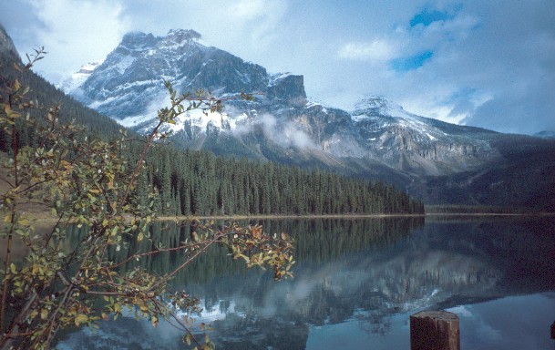
The road to Moraine Lake was unfortunately closed due to snow. A hike around Emerald Lake goes through four different areas: dry side, alluvial fan, wet side, and moraine [1]. From the fan I saw a moose and her young in front of wet side. The picture shows the dry side.
Takakkaw Falls is the most impressive waterfall in the Rockies, which can be reach over a long, winding road leads. If you count all cascades the waterfall is 380m high. The largest cascade is 254m high. The falls are fed by glacial melt water. Thus, there was not that much water in the falls in October. The Icefield Parkway brings you to the most impressive sights in the Canadian Rockies in Banff and Jasper National Park.
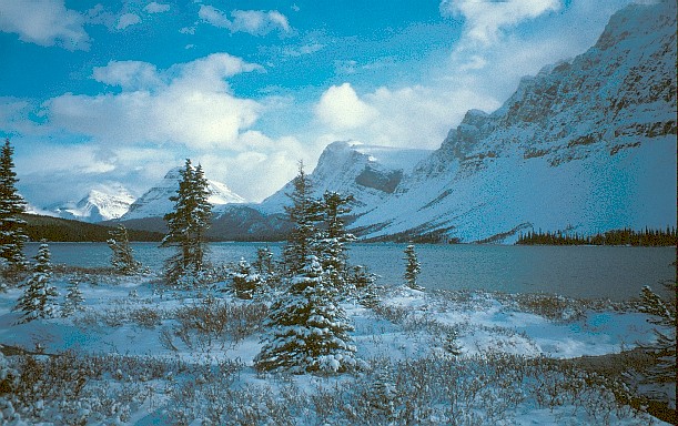
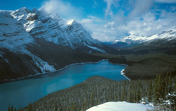
There was snow at Bow Lake. Right in the middle of the picture is the Crowfoot Glacier. Since everything is covered with snow, it is hard to identify the crow's toes that gave the glacier its name. At Bow Summit you can enjoy the great view over Peyto Lake into the direction of Columbia Icefield. The viewpoint is just a few meters away from the car park.
The Mistaya River has eroded the interesting Mistaya Canyon [1]. The canyon is so deep and narrow that you can hardly see its ground from the bridge over the canyon.
The area at Parker's Ridge was closed due to snow in October. Between Parker's Ridge and Athabasca Glacier you leave Banff National Park and enter Jasper National Park.
The Athabasca Glacier is fed by the huge and large Columbia Icefield.
Along the road to the toe of the glacier you can see signs with the years printed upon, which show how much the glacier shrank in the last 100 years (and that's a lot!).
The visitor center provides you with some interesting information on the glacier (see the exposition in the basement - rather than the cafeteria on the first floor).
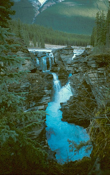
The Sunwapta Falls [1] were not very spectacular.
At Maligne Lake, I wanted to make a boat tour to Spirit Island, but they were not operating anymore in October. So, I only took a walk along the shoreline to Schaeffer's viewpoint.
On the way back to Jasper, I stopped at Maligne Canyon and hiked trough/along the canyon. This is something you should not miss. Maligne River has eroded a very deep and sometimes very narrow canyon.
- Calgary & Canadian Rockies: http://www.alberta.com
- Dinosaur Trail & Drumheller: http://www.dinosaurvalley.com
© 2001-2009 Markus Nick


